Engineering insights, industry trends, and company news from the GEOMAK team.
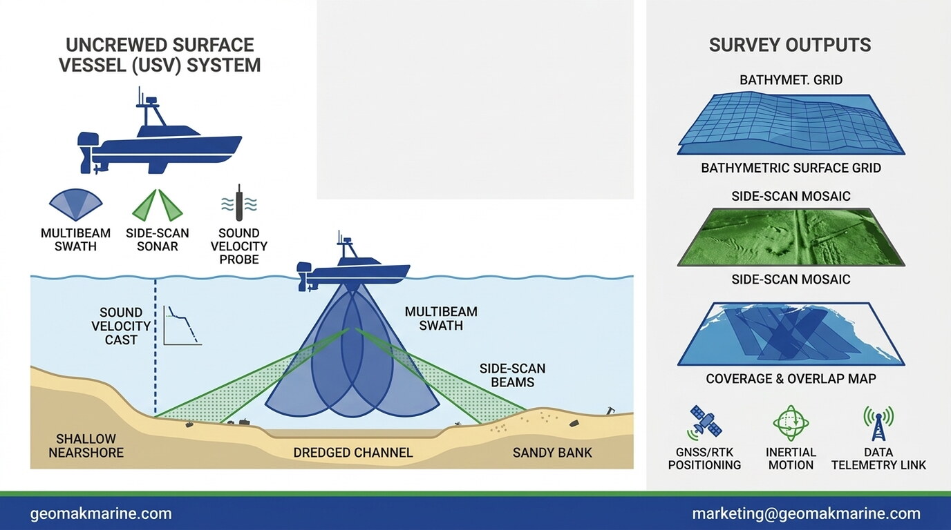
How uncrewed surface vessels combine multibeam, side-scan, and sound velocity sensors for shallow nearshore mapping
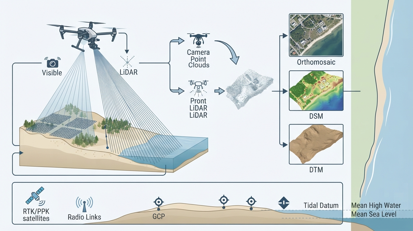
How UAV photogrammetry and LiDAR combine for terrain modelling, vegetation penetration, and shoreline extraction
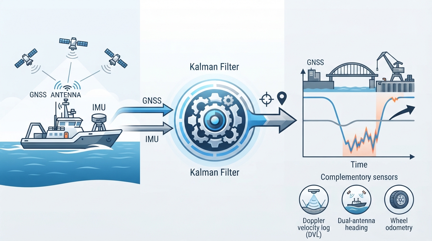
How IMUs, GNSS, and aiding sensors combine to maintain position and orientation during signal outage and dynamic motion
How multispectral satellite imagery & ground-level survey data support shallow-water mapping and long-term shoreline monitoring
How control point localization, machine calibration, and as-built validation ensure earthworks stay within engineering tolerances
How sound velocity profiles and multibeam echosounder geometry produce reliable bathymetric surfaces